

21 September 2026
Article written by Centre de Suivi Écologique (CSE), Senegal
At the heart of the Ouarkhokh Living Lab: using drone and Global Navigation Satellite System technologies to improve tree species inventories in agrosilvopastoral areas
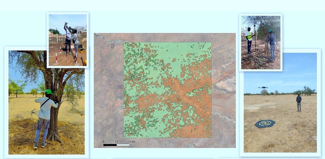
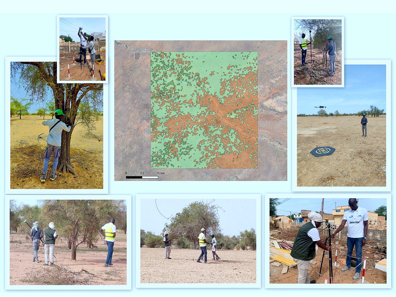
From 20 to 23 July 2026, a validation mission was carried out in the Ouarkhokh Living Lab, at the heart of Senegal’s sylvopastoral zone. Conducted by a team comprising Mr Al Housseynou Niang, Ms Adama Lo and Mr Abdoul Aziz Diouf, it aimed to test an integrated protocol under real field conditions, combining a woody species inventory, Global Navigation Satellite System (GNSS) positioning, digital data collection and drone imagery.
GALILEO and the Living Labs
Funded by Horizon Europe, the GALILEO project aims to strengthen the resilience of rural communities to climate change by developing agroforestry systems that integrate trees, crops and livestock. Its Living Labs are participatory experimentation settings that bring together researchers, farmers, communities and local stakeholders.
In Senegal, activities are being carried out in the Niakhar Living Lab in the Fatick region and the Ouarkhokh Dahra Living Lab in the Louga region. The July mission focused on Ouarkhokh to assess the technical and operational feasibility of the inventory protocol using the different tools.
Understanding trees in agroforestry systems
In the Ferlo, trees play an important role in agricultural and sylvopastoral systems. However, the size of the area, the limited accessibility of some locations and variations in woody vegetation density make monitoring difficult.
The tested approach links field observations with imagery acquired by drones and satellites. It is expected to support the mapping of individual trees by species, the characterisation of agroforestry systems and more accurate estimates of tree carbon stocks.
An integrated data collection process tested in the field
The protocol combines several complementary technologies. CHCNAV and Reach RS2 GNSS receivers are used to geolocate trees more accurately than a tablet’s GPS. Dendrometric measurements describe trunk diameter, total height and crown dimensions along the north to south and east to west axes. A drone captures aerial images used to produce detailed orthomosaics of the plots. Finally, the purpose built Land. Tree Survey mobile application centralises land cover, the scientific name of the species, measurements, coordinates and, where necessary, a photograph of the land cover or tree.
Three configurations were tested: measurements followed by a GNSS survey using a local base station; a drone flight and GNSS surveys conducted in parallel before the measurements; and RTK positioning using a permanent station in the geodetic network via the CORS NTRIP protocol.
Initial results and lessons learned
The mission covered six plots and recorded 276 individual trees. Observations indicate the dominance of Balanites aegyptiaca and Acacia tortilis, as well as the presence of other species characteristic of the agroforestry landscapes in the sylvopastoral zone.
The trials also confirmed the value of GNSS technologies in improving tree geolocation. However, some constraints related to site accessibility, connectivity and data collection time were identified.
These results will help improve plot selection, team organisation and the tools used in future field campaigns.
Improving innovations through field experience
The mission tested the Land.Tree Survey application under real field conditions and identified the improvements required. The application now supports offline data collection, the assignment of unique identifiers, quality control and data export.
It also links dendrometric measurements, GNSS positions, photographs and imagery acquired by drones and satellites in a centralised database. This integration will contribute to the development of artificial intelligence models for mapping trees, identifying species and improving carbon stock estimates.
The next step
The next step will be to organise a comprehensive field mission across both Living Labs. It will involve a multidisciplinary CSE team comprising specialists in agroforestry, GNSS and drone operations, who will cover all selected plots and ensure efficient and coordinated data collection.